July 29, 2022

Melissa Boyd
Rutgers University
Buluk – Geologically Speaking
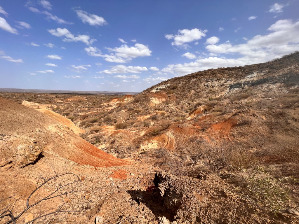
The last stop on the Turkana Miocene Project field tour was Buluk, Kenya, which has for many years been helmed by Ellen Miller. Located east of Lake Turkana, Buluk is an early Miocene site that is rife with…. everything! It is a geologist’s and paleontologist’s paradise alike, featuring everything from bone beds to veritable cliffs of volcanic tephra (volcanic ash or tuff). Looking for an entire forest of fossil tree trunks and branches? Check. Fossil bones of every sort littering the surface? Check. Thick paleosol exposures, featuring both red AND green? Check. I have been working in the Turkana Basin for a few years, on both the west and east sides, and I must admit that Buluk has been my absolute favorite to work in, geologically speaking.
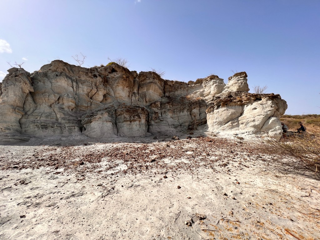
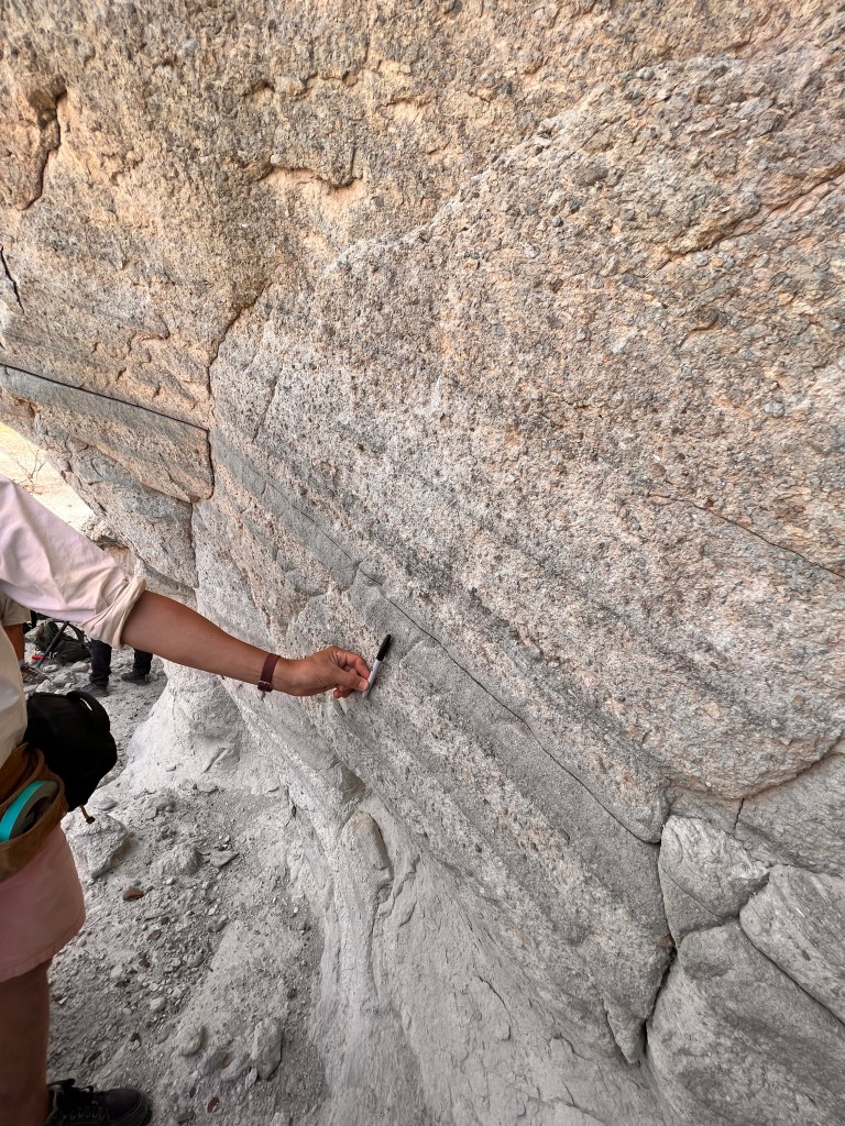
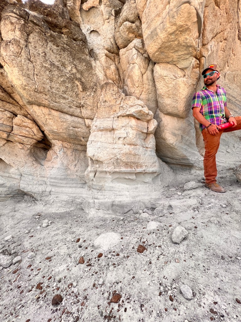
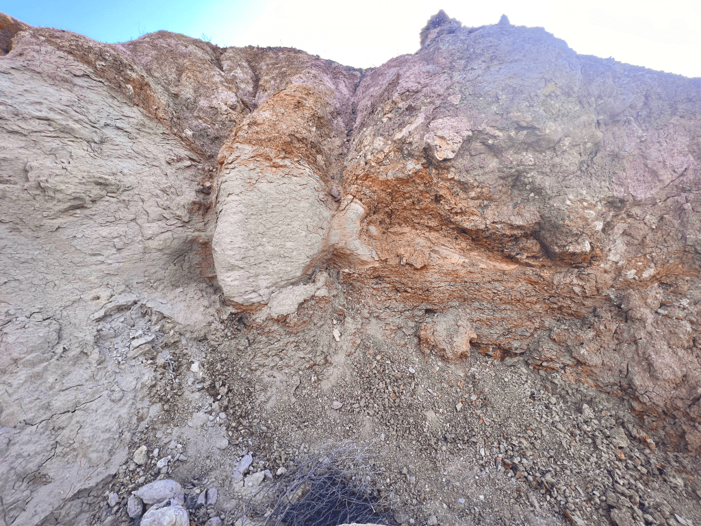
Buluk hosts several imaginatively named collection areas, including Dead Elephant, Smiling Lion, Valley of the Moon, the Big Sieve, Aaron’s Bone Bed, and more. Of particular interest, geologically speaking, are Valley of the Moon and Dead Elephant. Valley of the Moon is as the moniker evokes – a powdery wonderland of volcanic tuff, seemingly tens of meters tall.
The units of tuff are as varied as they are beautiful: some are massive with no discernable structure, some are beautifully cross bedded, some are planar bedded with large pumice clasts, and some even appear to have graded bedding.
Not only is this tuff geo-fabulous, but it is also useful for determining geologic age, if there is another tuff to which it can be correlated. Tuff can be used in the science of tephrochronology, or a process that now often uses Laser Ablation Inductively Coupled Plasma Mass Spectrometry (LA-ICP-MS) to chemically “fingerprint” the ash, obtain that chemical formula, and use it to compare to other ashes that have been tested. In this way, the ash can be traced back to a single volcano. Additionally, it is often possible to absolutely date tuff via radiometric 40Ar/39Ar (argon/argon) dating if it contains feldspar crystals. Needless to say, the Valley of the Moon may be a giant leap for Miocene mammal-kind.
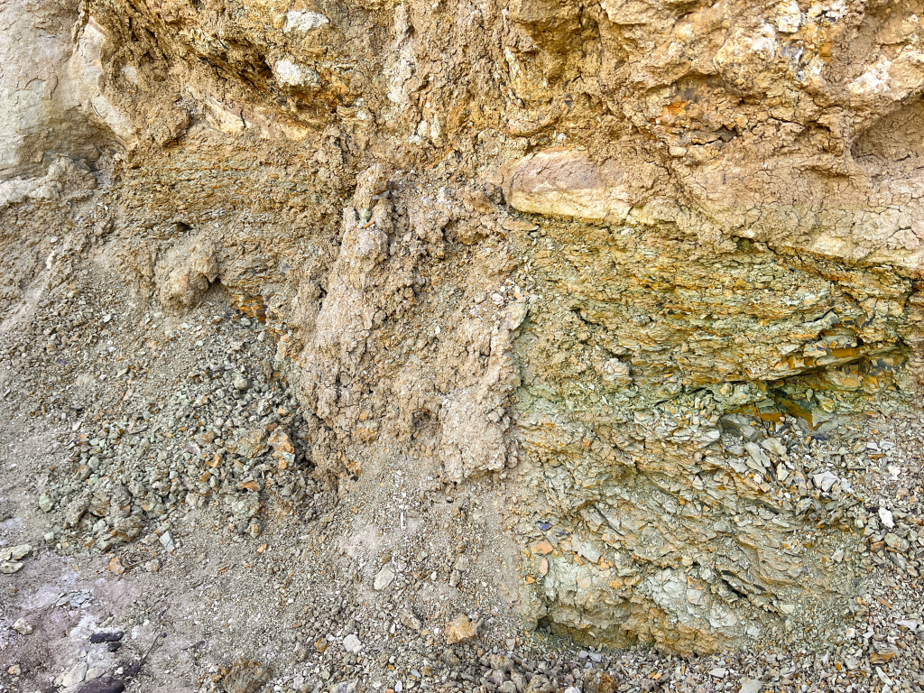
Although the Buluk Member type section is not located here, Dead Elephant is perhaps the most important area, geologically speaking. Just as Buluk has something for every Earth scientist, Dead Elephant has all the things for the geoscientist.
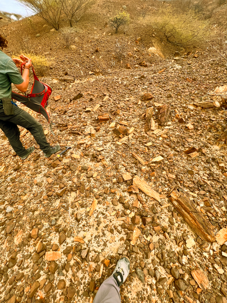
It appears that much of the member is exposed here in some fashion, albeit not as neatly laid out as in the type. Here, one can see fluvial (river) sequences, some volcanic deposition, which may ostensibly house the fossil trees, thinner exposures of the aforementioned tuff, an interloping tongue of basalt, a capping basalt, and even a messy debris flow, replete with basalt boulders, in which a small, mind-boggling lake deposit is nestled.
Understanding the processes that went on during Buluk times most certainly comes down to understanding Dead Elephant. All in all, our time working at Buluk was super deluxe!
July 24, 2022
Ruth Tweedy
Lamont-Doherty Earth Observatory
All plants produce waxes, which act as a waterproofing layer on the outer surface of a plant, and protect it from the environment. As an organic geochemist, my research involves studying these plant waxes and trying to understand what they can tell us about the environment. By studying the chemical signals in a plant wax sample, we can predict the type of photosynthesis a plant uses, look at the water availability at a site, and possibly even predict the plant type itself (e.g. tree vs grass).
Thanks to our developing understanding of modern plant waxes, we can apply this knowledge to the past. By recovering plant waxes which have been buried in sediments at a site, we can reconstruct a site’s ecology. If we can take many samples at a site, we can develop a timeline of the types of photosynthesis and plants that existed at a site at different times, as well as looking at rainfall dynamics.
As you might imagine, to do these ecological reconstructions we rely heavily on the work of geologists and geochronologists who have (or – in the case of the TMP – still are!) working at a site. To sample sediments at places like Lothagam, my supervisor and I spend our days walking up through geologic “sections”, collecting samples as we go. By tying our samples into previously dated and mapped geologic units, the samples we collect can be slotted into the history of the site.
When collecting our sediment samples to take back to the US for analysis, it is important to sample from rocks which have the best chance of preserving plant wax molecules. We prioritize two key features when deciding where to sample: pigmentation and particle size. Dark, deeply pigmented colors tend to indicate a greater concentration of organic material (although as Lothagam taught me, it can also indicate lots and lots of rust…) and fine clayey or silty sediments are the most likely to preserve these molecules within their matrix.

Once our field season is up, the next steps will be to export our samples, and to analyze our (hopefully plentiful!) molecules from the sediments. In the lab we crush up our sediments and use a solvent extractor (essentially a chemical lab’s espresso machine) to remove the plant waxes from the sediment. We then analyze the plant waxes on a mass spectrometer to look at the distributions of different molecules, and the isotopes they contain.
Based on these chemical signals, we can suggest what the ecology of the site was like in the past. Ecology is so important because it directly impacts the fauna which were living at the site at this time, but it can also suggest what the climate was like to support such an ecosystem. Our ecological reconstructions based on plant molecules can be compared to the animal fossil record at the same site at the same time, allowing us two ways to understand the environment.
July 18, 2022

Mae Saslaw
Stony Brook University
The Life of a Soil Carbonate
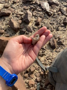
Soil carbonates are small pieces of calcium carbonate rock that form within a soil. In order to produce the kinds of nodules I study for my PhD project, the soil should develop in an environment where cycles of wetting and drying can concentrate the carbonate ions from soil water and, over hundreds to thousands of years, a small rock can grow. Most of the nodules I collect for the Turkana Miocene Project (TMP) are just a few centimeters across, large enough to observe features like organic matter, clays, and veins of other types of calcite.

When I find new samples in the field, I write down and photograph their context. Several members of TMP are interested in paleosols, preserved sequences of soil from the Miocene that we examine for their physical and chemical properties. Paleosol descriptions alone can tell us a great deal about the environment, such as what kinds of plants may have grown there, what kind of material composed the soil, and how much rain percolated through the ground. Not all paleosols contain soil carbonates, but for those that do, we can learn even more by measuring their stable isotope ratios.
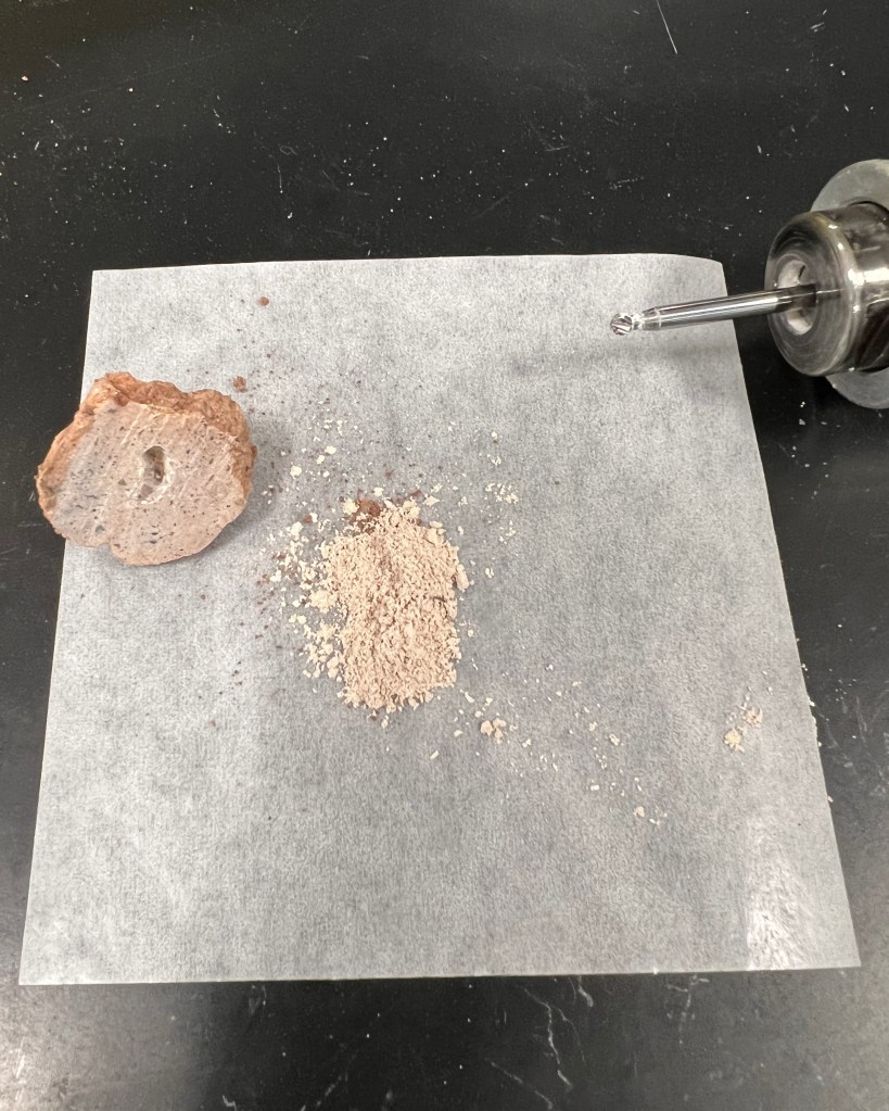
As a soil carbonate forms, it captures carbon and oxygen from the soil. By measuring the isotopic properties of the carbonate today, we can interpret a record of the plants, water, and temperature conditions of the past environment. At The Henkes Lab at Stony Brook University in New York, I measure carbon dioxide (CO2) from the rocks our team collects in the field. In order to do this, I first cut each sample to look for a fine carbonate texture called micrite, which indicates that the rock represents soil conditions and not a later process in which calcite from another source infiltrated the soil layer.

The next step is to powder the sample for analysis; I use a small drill to carve out a spot where the carbonate is as pure as possible while producing enough of the powdered sample to measure. Depending on how much clay or other material is present, each analysis requires about 6–12 mg, and I analyze each sample at least three times.
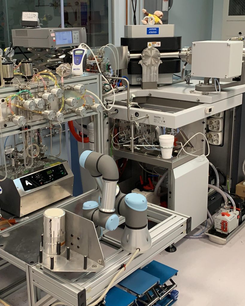
Our clumped isotope device is a sophisticated instrument that extracts CO2 from the powdered sample and delivers it to our isotope ratio mass spectrometer. The carbonate is dissolved in acid, the released CO2 is frozen, and all impurities are removed. This process takes just under an hour, followed by two hours of repeated measurements of the gas from the sample compared to a standard gas with a known isotopic composition.
Finally, I use the measured values of CO2 clumped isotope ratios to calculate the temperature under which the carbonate formed. In many cases, the soil carbonate samples come from sediments near fossil discoveries, so we can begin to understand the environments in which plant and animal communities lived and evolved. This adds a valuable dimension to the TMP Climate team’s reconstruction— if we can gather temperature data across our sites and spanning the full temporal range of the Miocene, we can track an important aspect of the climate change that our earliest hominin ancestors experienced.
July 11, 2022
Indrė Žliobaitė
University of Helsinki, Finland
My name is Indrė Žliobaitė, I‘m an associate professor at the University of Helsinki, Finland. In this field trip I represent the Life team of TMP. Life team is looking how faunal communities have changed over time and space in the context of changing environments across all TMP sites as well as within a broader context of East Africa.
We characterize faunal communities by their functional traits and investigate how and under what circumstances faunal communities change. Composition of mammalian communities also allows us to predict in under what environmental conditions those communities lived.
My main work within the project is at museum collections scoring functional traits and at my computer, developing tailored computational models for analyzing faunal communities and their environmental contexts.
At this field trip I’m not collecting samples; rather I’m documenting what fossils we see on the ground. I record what it is, from where and from when, the size, the color of a piece, whether it is in sediment or on the surface, I also record the preservation condition and completeness of the body part preserved. This will help to better understand how the fossilized translate to the living communities and the other way around.
I’m also watching colleagues at work and discuss a lot to understand where fossils come from, what depositional environments TMP fossil sites represent and how likely that faunal assemblages represent animals that actually lived together.
This is my first camping-style field trip. So far, it’s wonderful!

July 6, 2022

Cynthia Liutkus-Pierce
Appalachian State University
After 6 long years, I was able to head back to Loperot, Kenya—and this time, a huge team of collaborators from around the world joined me!

I originally visited this Miocene fossil-bearing site (on the western side of Lake Turkana) in 2012, and then in 2016 we dug an enormous trench through about 30m of stratigraphic section. I was anxious to get the TMP team out there to see what remained of our previous excavations and to have 20 sets of new eyes taking a look at the Loperot sediments. The 2016 trench had filled back in, but luckily we were still able to locate all 30 previously identified stratigraphic units.

We had several objectives for Loperot–we wanted to improve our estimate of the age of the site, understand how much time was recorded by the stratigraphy, and study (in detail) the paleosol morphology, plant biomarkers, fossil distribution, and sedimentary geochemistry preserved in the strata in order to reconstruct the Miocene paleolandscape and paleoenvironment.
With a divide-and-conquer attitude, the TMP team descended on the region. We reopened the 2016 trench and scouted new outcrops to the east and south, which extended the stratigraphy above and below the 2016 trench excavation. We sampled and described 8 separate ancient soils, found potential lake sediments for biomarker analysis, conducted “bone walks” to survey for fossil distribution, collected samples for phytoliths and pollen (both modern and ancient), and scouted igneous intrusions throughout the region. We didn’t find a second whale fossil, but given the amount of work we were able to complete in our short 6-day field season (and that our preliminary observations are already supporting some previous hypotheses), I would consider our Loperot fieldwork a success! We celebrated in style with a proper dance party on our last night, complete with Congolese music and sweet dance moves from the Turkana crew, TBI associates, and the TMP researchers.
April 11, 2022
TMP Team
In early 2022, we lost our dear friend, colleague, scholar and leader of the Turkana Miocene Project, Isaiah Nengo. We are deeply saddened by this tragic loss and we are committed to carrying on the project research, as Isaiah would have insisted, and we do so in his honor and in his memory. A tribute to Isaiah’s life and work written by TMP members and published in Nature Ecology and Evolution can be downloaded here.
